-
 CISA has issued a cybersecurity emergency directive that instructs federal agencies to identify and mitigate Cisco firewall vulnerabilities, most likely to be targeted by the ArcaneDoor threat actor.
 -
Louisiana Gov. Jeff Landry credited investments in coastal protection and levee infrastructure for how well the bayou weathered Hurricane Francine and hopes it will translate to lower flood insurance premiums.
-
Pacific Gas and Electric used low-flying helicopters equipped with hi-res imagery technology and light detection sensors to build 3D models that will show where fire risk may be highest. The data will also inform AI risk models.


More Stories
-
The declaration allows the West Virginia Emergency Management Division to post personnel and resources for quick response to any emergency that may develop. Coordinating agencies have been placed on standby to report to the EOC.
-
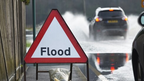
High-tide flooding has increased by 250 percent in the Pacific Islands and by 350 percent in the western Gulf since 2000, but projections suggest fewer events in 2024.
-
In August 2021, the Caldor Fire, one of the most destructive wildfires in California history, burned 175 of these cabins in its march up and over the Sierra Nevada crest, from Placerville to the Tahoe Basin.
-
As the storm was about 20 miles south of Savannah, Ga., on Tuesday morning, and 100 miles out from Charleston, it had tropical-storm-force winds that extended up to 205 miles out.
-
Chicago’s hospitals have been planning for a potential dark side to the convention. They’ve been developing plans and practicing for influxes of patients should violence erupt or disaster strike at the convention.
-
A new tool from Rebuild by Design shows climate change is an equal opportunity hazard. But spending money ahead of time on mitigation and prevention can be more cost-effective than committing it after disaster strikes.
-
As railways increasingly rely on digital connectivity, a “strategic alliance” between Digi International and Cylus combines their products into a unified solution designed to offer better cyber protection.
-
After the gas is shut off, the electricity may be next because electricity is key for telecommunication lines, the sewer system and the fleet of pumps that help mitigate ongoing land movement by expelling the groundwater that geologists say causes it.
-
Lawmakers specified during the special session the recovery money can go anywhere, like for fire and flood relief efforts in northern New Mexico, besides the $10 million for the Mescalero Apache Tribe.
-
The Extreme Heat Emergency Act would classify extreme heat as a major disaster under the Stafford Act, which recognizes certain events as disasters eligible for a presidential Major Disaster Declaration.
-
With the added tools, researchers from the U.S. Geological Survey and Rutgers University hope to pinpoint the source, strength and duration of recent aftershocks while better identifying where the first quake originated.
-
California, Florida and Texas have the highest wildfire risk, according to the survey, and the Golden State leads by a large margin with expected annual losses from wildfires totaling $1.4 billion.
-
The standards are for new buildings and will offer the minimum protection from 97 percent of the tornados experienced in the United States. For areas with potential for EF5 Category storms, building a safe room may be necessary.
-
The Colorado Department of Transportation conference lasted two days. A demonstration gave planners and engineers a rare firsthand view of how the way they build new roads could protect or endanger in the event of a crash.
-
A floodplain map is a map showing areas of a community that are at risk of flooding. The maps are divided into zones that indicate the likelihood of flooding based on historical data and other factors.
-
The county disaster and emergency services coordinator and director of the Office of Emergency Management told county commissioners Thursday that the restrictions were "a unique extra tool that we deploy when necessary.”
-
The states were ranked by number of hospital beds per 1,000 people. Washington was the state where patients are least likely to find an available bed, while Mississippi residents were the most likely to find a bed.
-
The local emergency management agency said the U.S. Army Corps of Engineers conducted a safety assessment on Tuesday and reported that the dam now needs repairs.


Most Read
